
We have developed an efficient collaborative weed monitoring system by drone swarms, which is robust and scalable.
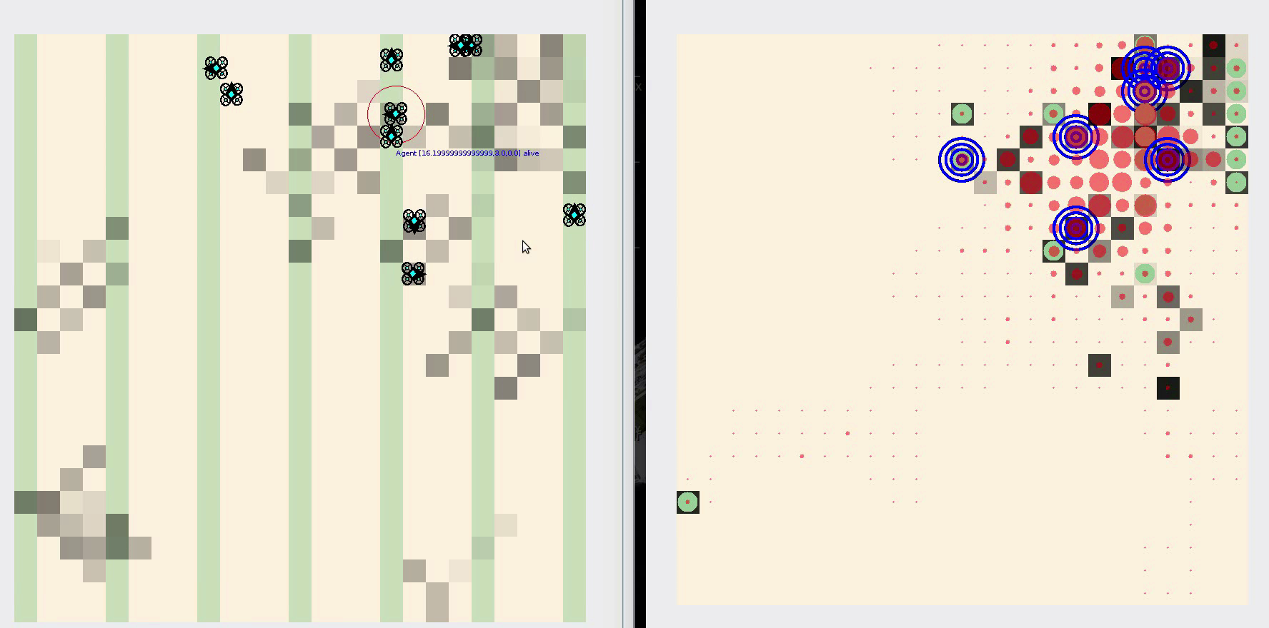
In this video, a swarm of simulated drones searches for weeds in a crop field. The field is virtually divided in cells, and each cell may be occupied by weeds (grey level indicates weed density) and/or crops (green). On the right side, the information available to all drones is displayed, in terms of number of visits per cell and discovered weed density. Also, drones can attract other drones placing virtual beacons that remain active for a given amount of time. In this way, certain areas of the field receive higher attention than areas devoid of weeds. Check it out!
Simulation of collective weed mapping from SAGA experiment on Vimeo.